


We hung out with the Hobo Group, Patrol 1 from the Mile High Jeep Club. We did two semi-moderate trails, which included T33A, Middle St. Vrain, and Coney Creeks Trails. They are all off the Camp Dick Campground, which is located by Allenspark, Colorado off of Highway 72 (not too far from Boulder).
The first trail we did was T33A “Plane Crash”. The start of this trail was close to the entrance of the campground. In the Funtreks Northern Colorado trail book, this is Trail #28, which includes Bunce School Road. The book says it is 13.6 miles roundtrip at 5-6 hours, but I do not think it took us that long.
We thought this trail would be easy, but it actually was a bit of rocky climb, with a couple more difficult places. The trail took us a couple hours to climb to the crash site. It was fun to really get to try out the new lift. Click the photo for a short video of one of the rocky parts.

The trail dead ends at the site of the crash with small parking area. There are some hiking trails that branch off to the plane pieces. A little history about the plane crash:
*On July 27th, 1965, two people were killed in the plane crash while flying a T-33A jet trainer. Tthe pilot was a very experienced Air Force Major named Jay Currie. First Lieutenant Donald Darby was riding along as a technical observer. They were flying from Buckley Field to California, and Major Currie was viewing some property he owned in Colorado, flying at 13,000 feet.
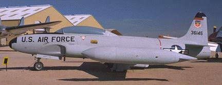
Cause of the crash remain unknown. The facts are that the plane was flying slowly, there were no technical issues with the plane, and neither pilot attempted to eject from plane before it crashed. Thunderstorms were reported in the area, which may have been a probable cause behind the crash. Last contact was when the pilot was instructed to fly at 17,000 feet by Air Traffic Control.
*Source: TrailDamage.com


Difficulty Level – 5-6/10 (we had a couple of stock JL’s on the trail, which did it just fine-there are also some easier spots if the big crevices aren’t your thing).
Scenic Level – 6/10
Traffic Volume – 3/10 (mostly ATV’s and dirtbikes, with minimal places to pull over)
Camping – There are two campgrounds at the base of this trail, as well as some dispersed tent camping at the beginning.
We headed back down to Camp Dick and then started the next trail, which is at the end of the campground. Definitely watch out for hikers at the beginning, as it is a heavy hiking trail.
In the Colorado Trails, Front Range Region book, Middle St. Vrain & Coney Creeks are under Trail #10 and Trail #29 in the Funtreks Northern Colorado book. The book rated it a 7, but we would say more like a 4-5 at the most. The beginning had the rockiest areas and the trails had a bunch of fun water crossings.


It was comical to watch a Nissan truck attempt the beginning of the trail. Somehow it got right in front of us, so we just laughed at each time it tried to go over some big rocks! We also had a vintage unibog come up behind us. It was amazing to watch it go over the trail.
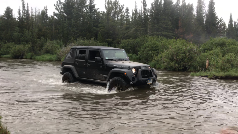
Close to the end of the trail was the biggest water crossing (click the photo above for the video). It did have some hidden rocks, so you couldn’t go too fast. There was a foot bridge along the side for hikers to cross.
The trail ended at Beaver Reservoir, just North of Ward, Colorado. We even saw a moose right outside the lake area.

Difficulty Level – 4-5/10
Scenic Level – 4/10 (water crossings were fun and then we saw a moose at the end)
Traffic Volume – 2/10 (watch out for hikers)
Camping – There are the two campgrounds at Camp Dick and then some dispersed camping just outside of Beaver Reservoir, though no waterfront spots at the reservoir.
We would go on these trails again, but maybe not do both of them in the same day (it made for a long day for the little one).


